TL;DR
We hiked Ougiyama (扇山) to practice hiking for Mount Fuji! It’s a moderately difficult hike we highly recommend in cool, overcast weather. Is there any hikes in Japan that you’re curious about? Let us know below and maybe we’ll hike it or message us to come join us!
Disclosure: This post contains affiliate links. If you click through and make a purchase, we earn a small commission, at no additional cost to you. Click here for our full disclosure!
Since Sara and I are planning to do Fujisan, we wanted to explore a bit of the Tokyo hiking scene. We were originally planning to do the Ougiyama to Momokurayama ridge trail, but the summer heat and humidity coupled with our lack of planning forced us to cut our original plans short.
While we’re not avid hikers, we have been known to walk long distances. If you take one thing away from this blog, it should be this: We highly recommend this hike in cool, overcast weather while carrying enough water to keep yourself hydrated (~2L per person).
Overall recommendation
We recommend this hike on a cool, overcast day in the fall or when the azaleas are blooming in April/May.
From Pineapples Difficulty Ranking: 🍍🍍🍍 – 3 out of 5 Pineapples!
*If you’re wondering what our difficulty is based on, read about our ranking system.
There are a lot of blogs that rate this as a moderate hike, and we agree – with the caveat that the weather should be sunny / slightly overcast, in the 80’s, and you should have ample water. Since we’re not the most athletic of couples, we’d also say that this trail is pretty difficult to do during a Tokyo summer, and you should most definitely not do it when it’s 90 degrees out like we did or if it’s storming.
Hiking Ougiyama details
Overview
Ougiyama (扇山) is a 1,138 meter mountain in Otsuki located within Yamanashi prefecture. It’s been designated as one of “Yamanashi’s 100 famous mountains” and has one of the best views of Fujisan (when clear).
Total time (transit + trail): ~9 hours
Transit time (train): 3 hours
Transit time (walking to trailhead): 1 hour, 40 minutes
Trail time: 4 hours, 10 minutes
Trail details
Directions to the trailhead
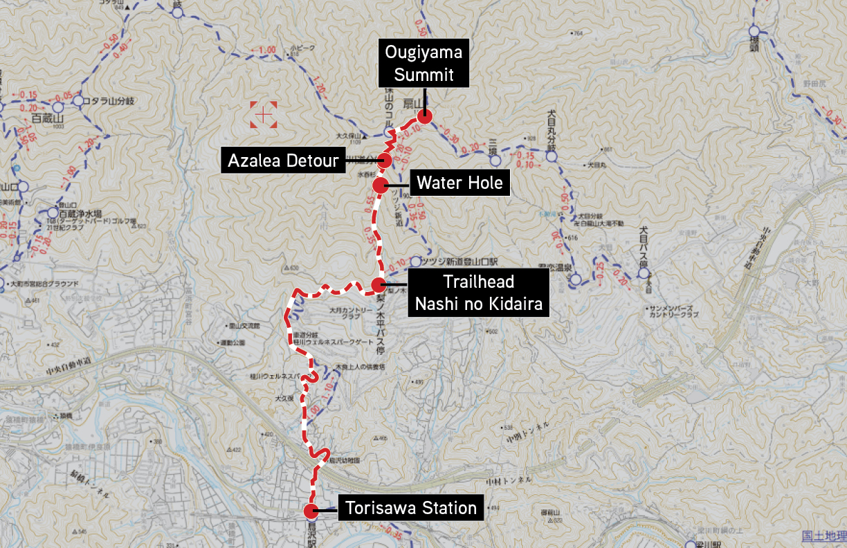
- Starting / ending station: Torisawa station (鳥沢駅 Torisawa-eki)
- Estimated time from Shinjuku station: 1.5 hours
- Estimated time from Torisawa station to 梨ノ木平 trailhead (walking): 60 minutes
If you’re coming from central Tokyo, it’ll take about an hour and a half on the train to get to Torisawa station from Shinjuku. There’s a few ways to get there, so I won’t list them all; just use your favorite transit app to figure out what’s appropriate for your timing.
We took a Chuo-sen Rapid to Takao and transferred to the Chuo Local Otsuki to Torisawa – it cost us about $12 one way. You can get there cheaper taking the Keio Line from Shinjuku to Takao, but it doesn’t run as frequently.
Once you arrive at Torisawa station, it’s about a 60 minute walk to the trailhead. As a note, it’s about 45 minutes to a small wooden 梨ノ木平 sign which looks like a trailhead, but it’s a slight shortcut to avoid the winding road. Watch out for a lot of spiders here! We have a photo of what to look for below.
*There is also a “hiking bus” that can take you from Torisawa station to the Ougiyama trailhead, but it only runs on weekends and holidays from April to July and September to November. This should give you an idea of when it’s suggested to hike here, but I definitely wouldn’t advise hiking during the rainy season (between June and July). Here’s the schedule if you are planning on hiking Ougiyama during those months. As a note, there’s no return bus to get back to the station, so you’ll have to walk back like we did.
What we brought
- Salomon GTX hiking shoes (Ultra 3’s for Ryan and Sara)
- I brought my Topo Designs 23L mountain pack, Sara brought a small normal backpack (standard book bag size). They don’t make the version I have anymore, but it’s similar to this 30L one.
- 20 oz of water in a H2GO Hawaii Nexus water bottle
- Bug spray and sunscreen
- 1 ziplock of Calbee Fruit Granola
- 1L Aquarius sports drink (from 7-11)
- 2 Weider in Jelly Energy In drinks (from 7-11)
- Onigiri, chicken + musubi bento, and choco-pan (from 7-11)
Tips
- There’s a 7-11 a few minutes from Torisawa station. Would definitely recommend stocking up here on onigiri, Pocari Sweat, and Weider in Jelly drinks.
- There’s a water hole about an hour into the trail. While I can’t say that it’s 100% safe to drink (and couldn’t find any Japanese blogs that said it was ok), there is a lot of signage pointing it out – so we figured it safe. We drank from it on the way down the mountain because we were so dehydrated, and we were fine, but again, your mileage here may vary.
- Bring a picnic mat for the summit so you can sit in the shade. There’s also a lot of ants at the top, so it’s nice to be able to sit and relax on something without wondering if something is crawling up your leg.
- Do not take the side trail to the azalea’s unless it’s during April/May. There aren’t any English blogs that mention the azalea path, but a number of Japanese ones did. We took the detour just to check it out because we’re curious like that. Since it wasn’t in season, there’s just a lot of dead trees. There’s a guide rope as well because the trail becomes very narrow in places. I’ve included photos of the detour below. As a note, this detour only goes down from here, so you’ll have to walk 10 minutes to the viewing point and walk back to the main trail.
- Bring athletic shoes for the walk to and from the trailhead. Walking in hiking shoes is pretty difficult on asphalt. We would definitely recommend doing this if you can afford to carry the weight.
- We would not recommend doing this hike in August when temperatures average 90 degrees. If you really must do it then because of travel plans, make sure you bring at least 2L of water per person.
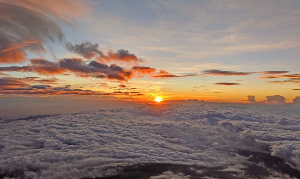
- Do not do this hike in the summer if you want to see Fujisan. If your main goal is to see Fujisan from the summit of Ougiyama, do not do this in the summer as Fujisan is generally covered in haze / cloud cover and doesn’t have its infamous snowcapped look.
Pros
- If you hike this on a cool, summer weekday, you will probably run into very few people, if any. It’s kind of neat sitting on top of a mountain in a metropolitan area of 40 MM people without a single other person around. Kind of reminds me of what a zombie apocalypse might feel like, but without the zombies.
- If you like nature like I do, there’s a lot of different critters crawling around. If you’re lucky, you might even get to see a tanuki!
- On a clear day, there are absolutely beautiful views of Fujisan.
Cons
- You will run into very few people; while this is also a pro, if something were to happen to you on the mountain, it might take a while to get help. If you’re scared of being the only person on a trail, definitely avoid this one during the weekday.
- It’s a fairly steep trail, and I can imagine that if it were to rain, hiking Ougiyama would be pretty miserable.
- The bus to the trailhead runs only on the weekends/holidays during certain times of the year, so it’ll be an hour walk to the trailhead and back.
- There are a lot of bugs. I’d suggest bringing trekking poles or finding a stick to clear the path when on the shortcut to the trailhead. See our photos photos below. There are a lot of spiders that have made their homes across the path. If not, you’ll end up with a lot of spider webs in your hair – trust me, I know.
Photos from the trail*
*Photos are in chronological order with the first picture being from the start of our hike.
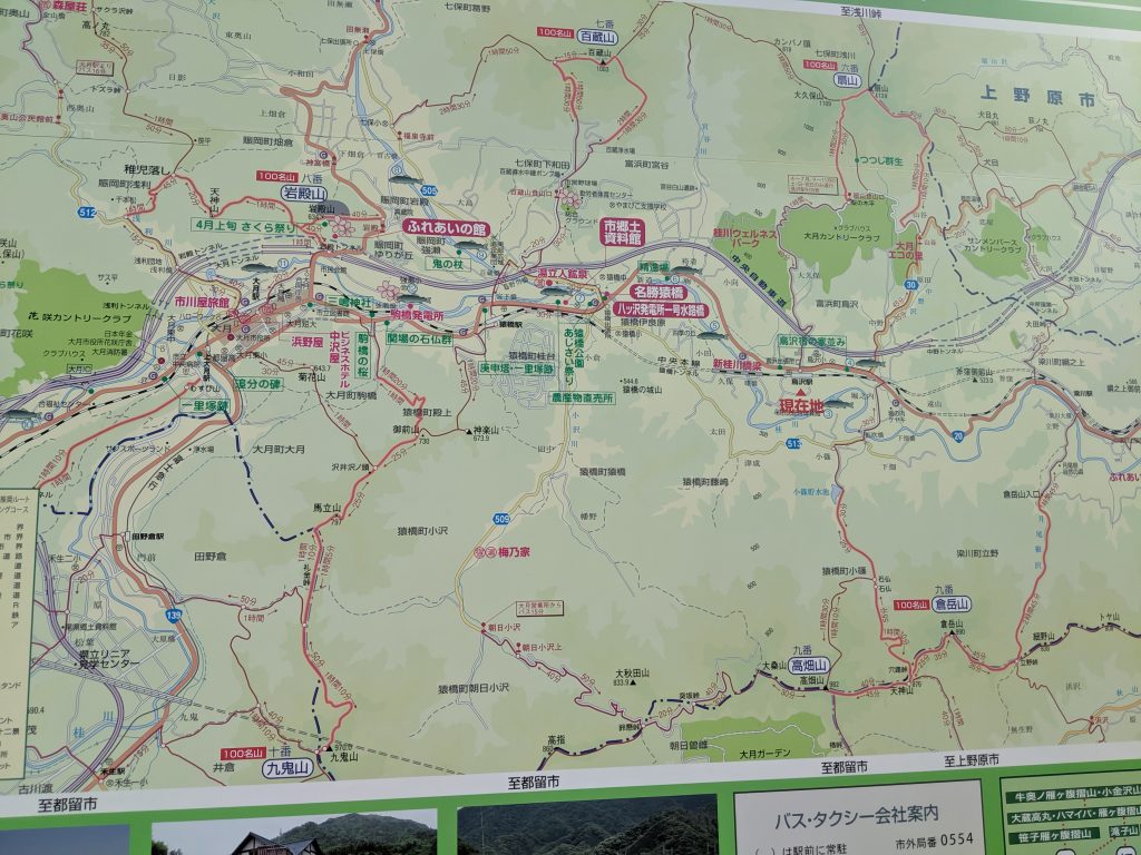
Map of the area in Otsuki outside of Torisawa station with the various trails. 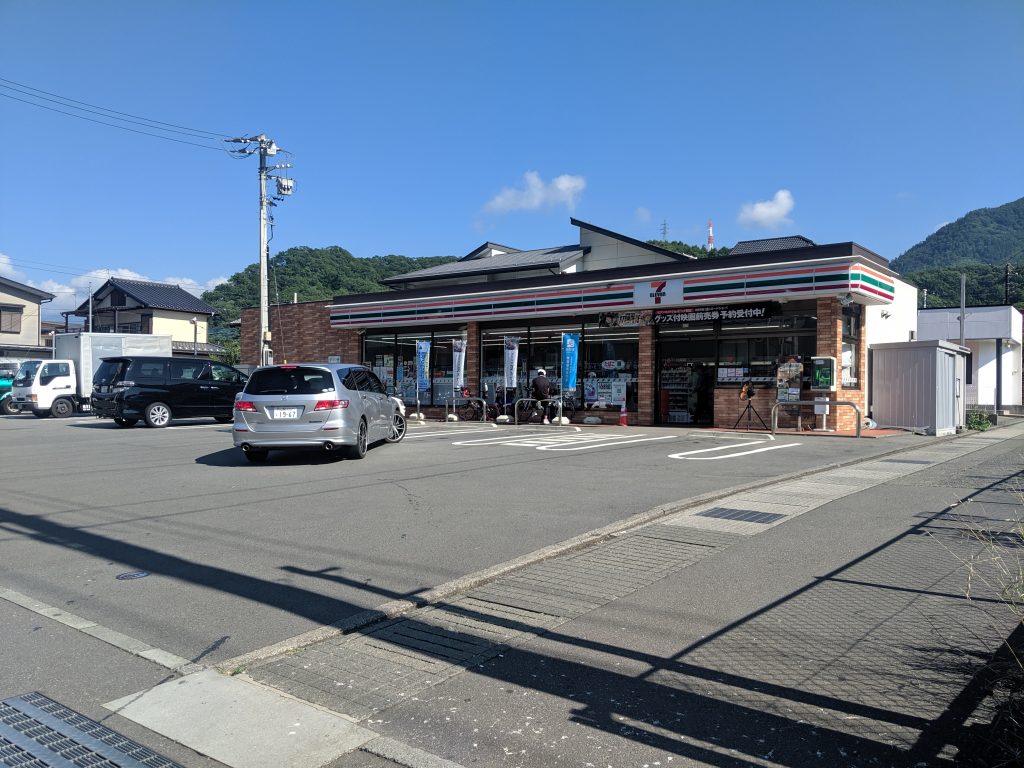
This is the 7-11 a few minutes from Torisawa station. 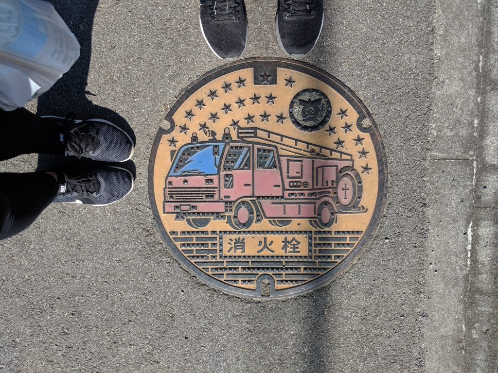
Japan has a lot of neat manhole covers. It’s a thing. 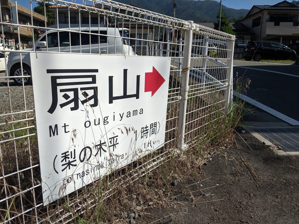
Sign outside of Torisawa station pointing out the direction of the trailhead. 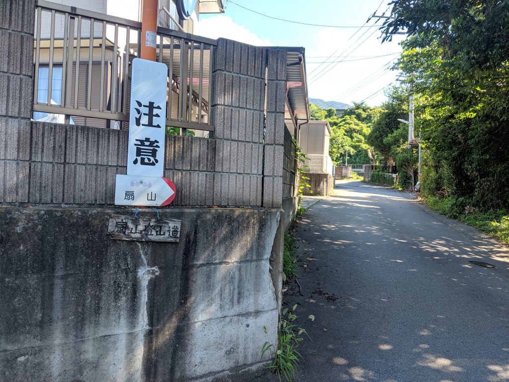
Lots of signs pointing you through the residential neighborhood from Torisawa station. 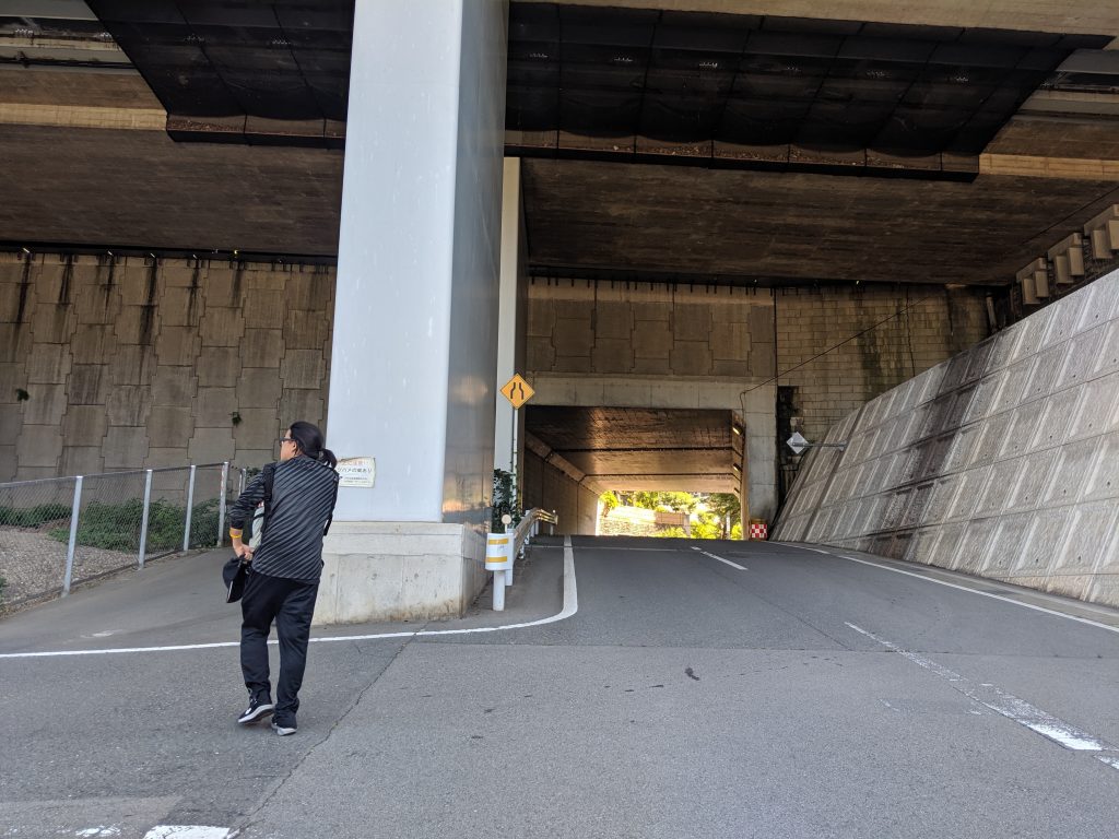
You’ll need to pass under the overpass to get to the trailhead. 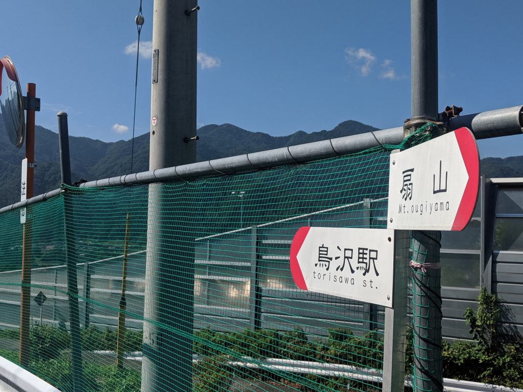
Still more signage pointing the way to Ougiyama 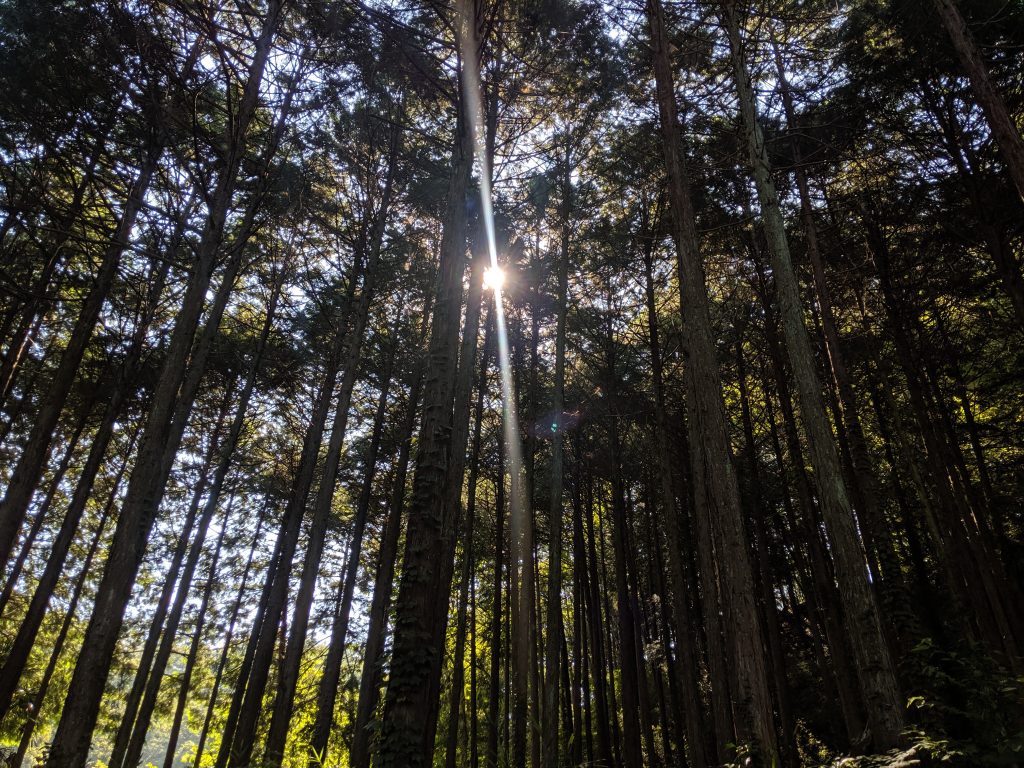
Lots of tree cover even before you’re on the trail 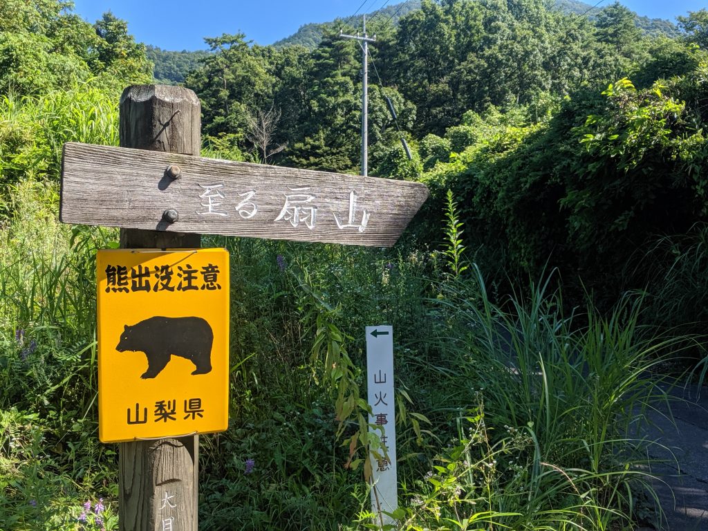
We brought a bear bell, just in case. 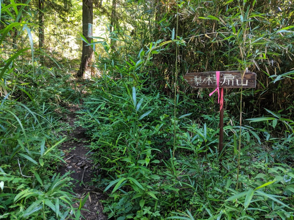
This is a sign pointing out a shortcut to the trailhead so you can avoid the winding road. Watch out for lots of spiders here! Use a stick to clear the path! 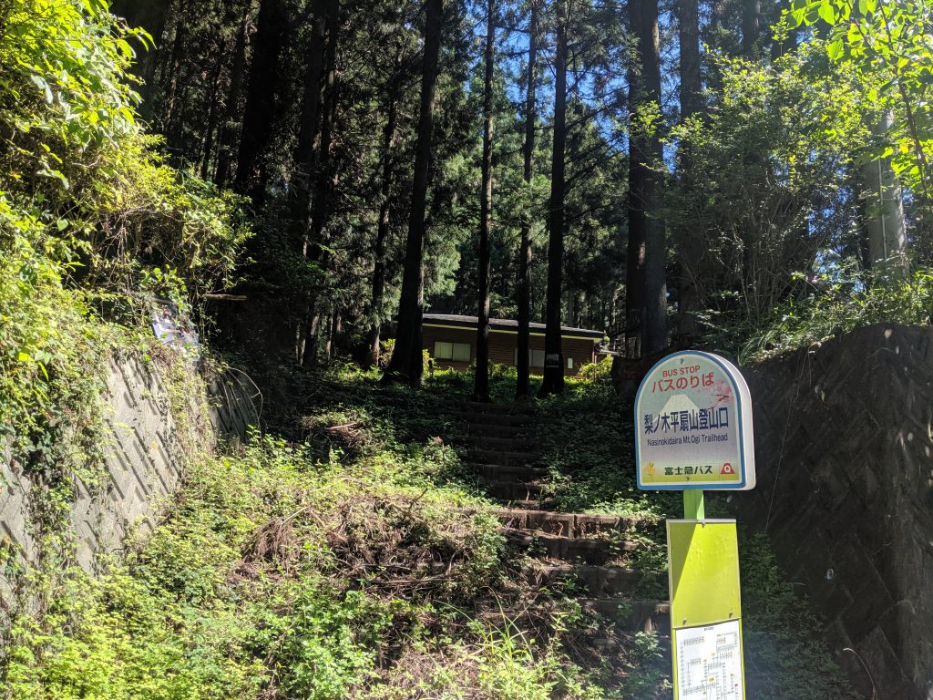
This the start of the trailhead. Notice that the bus will drop you off here if it’s running. 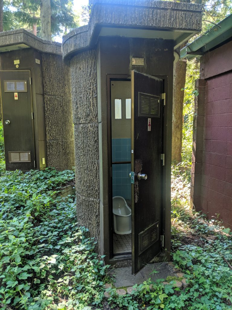
Both men/women bathrooms are available at the trailhead. Watch out for spiders in the urinals! 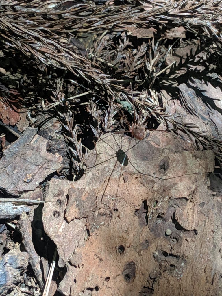
Lots of these spiders running on the ground. 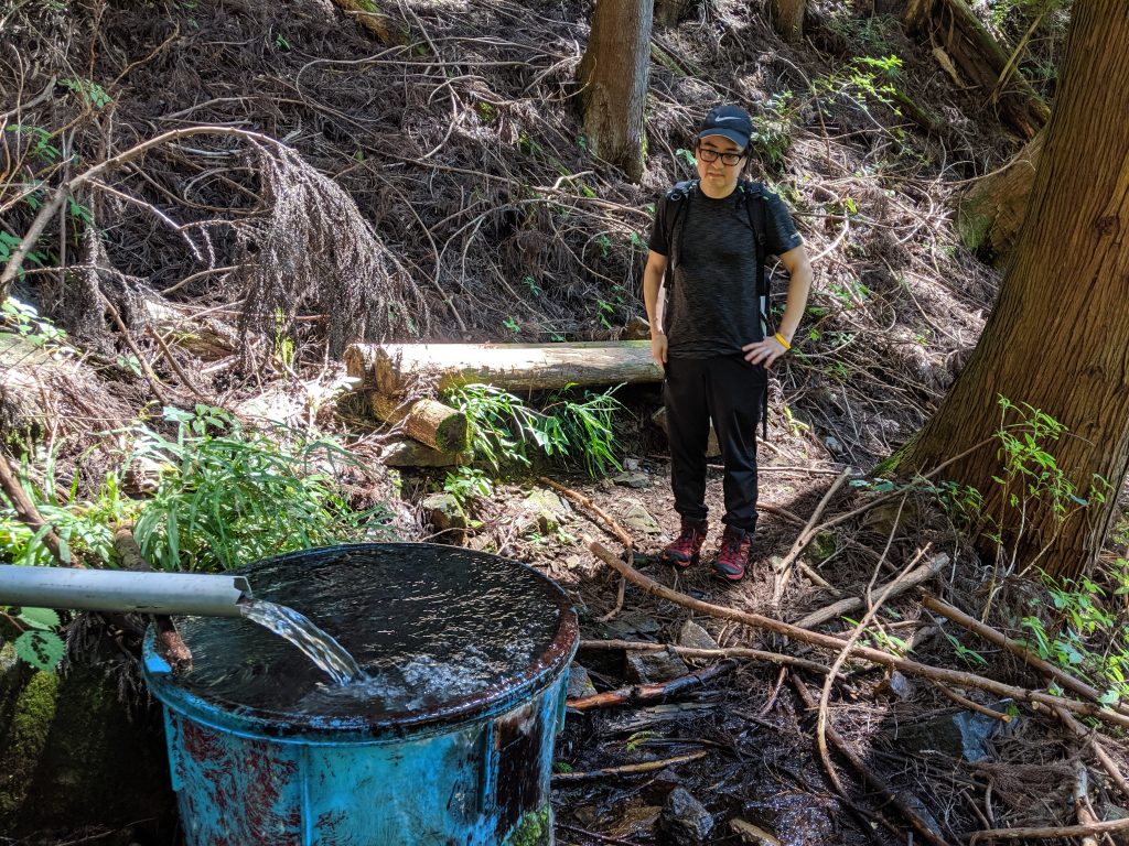
Ryan really was contemplating if it was ok to drink from the water hole. 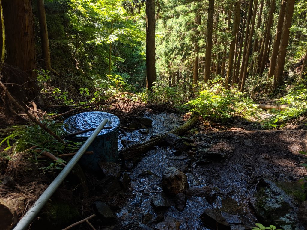
Water hole! We drank from the pipe feeding into the blue bucket. 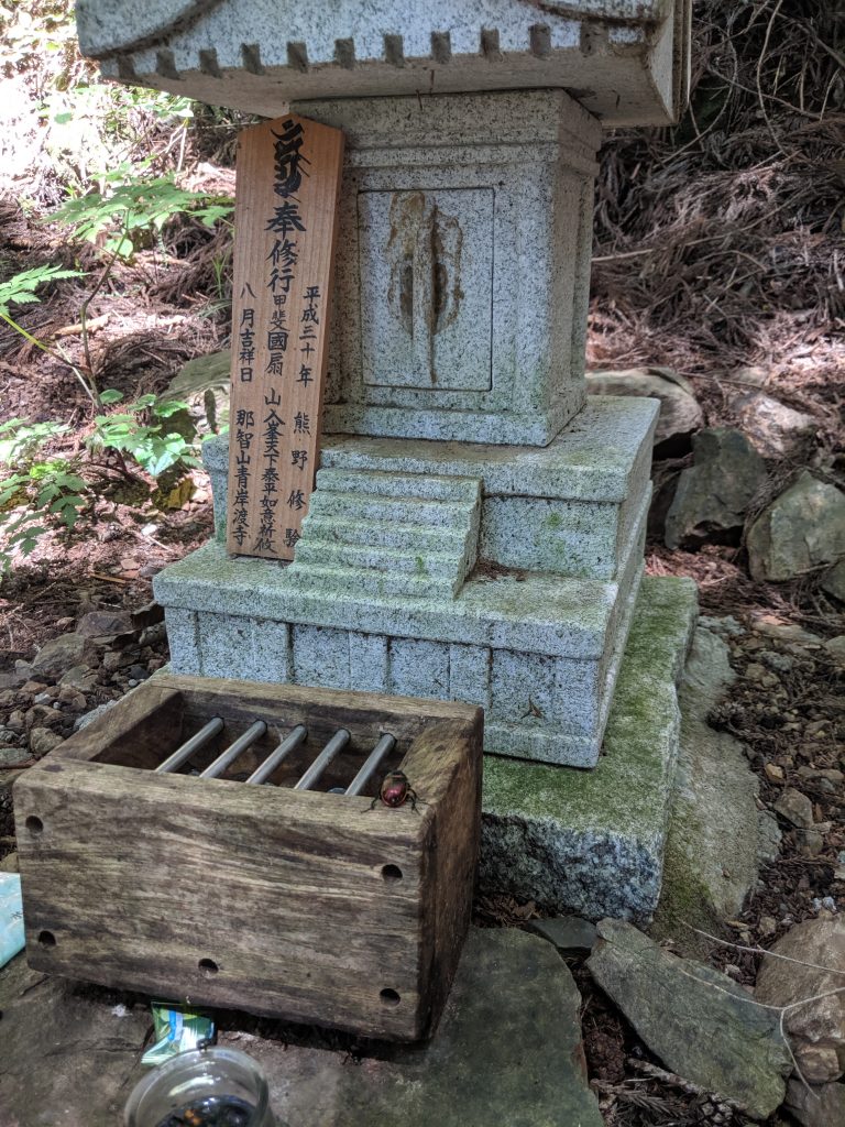
Leave money at the shrine for a good hike! 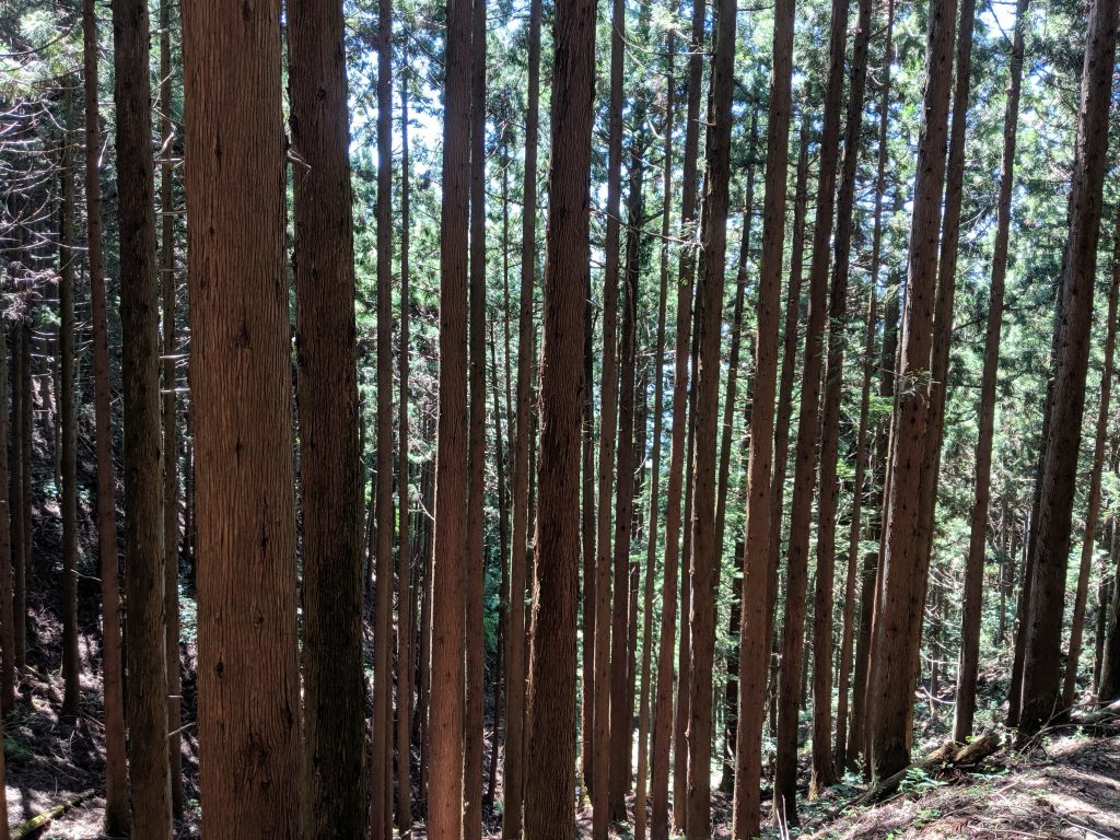
Climbing higher meant more and more trees. 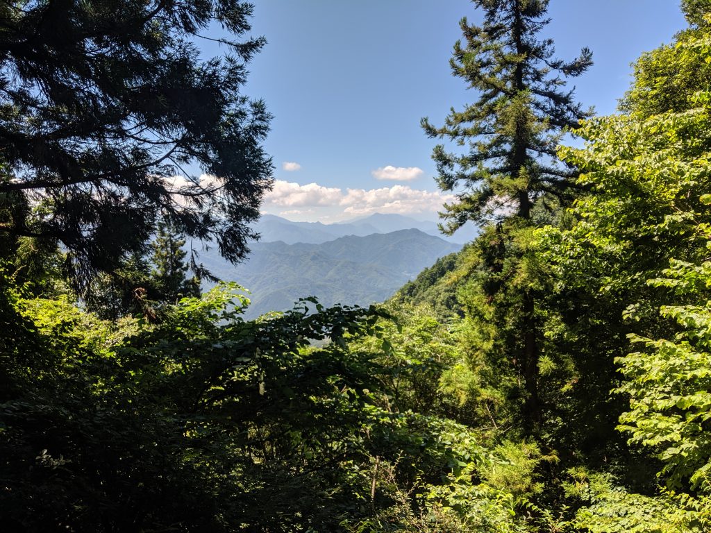
Our first view from a clearing on the climb up Ougiyama. 
Do not go to the right unless it’s April/May. A 10 minute detour to see the azalea. 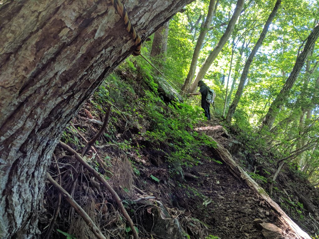
We’re adventurous so we we went to the right to take a peek even though the azalea weren’t in season. There’s a lot of rope because the trail narrows out quite a bit with a steep drop off. 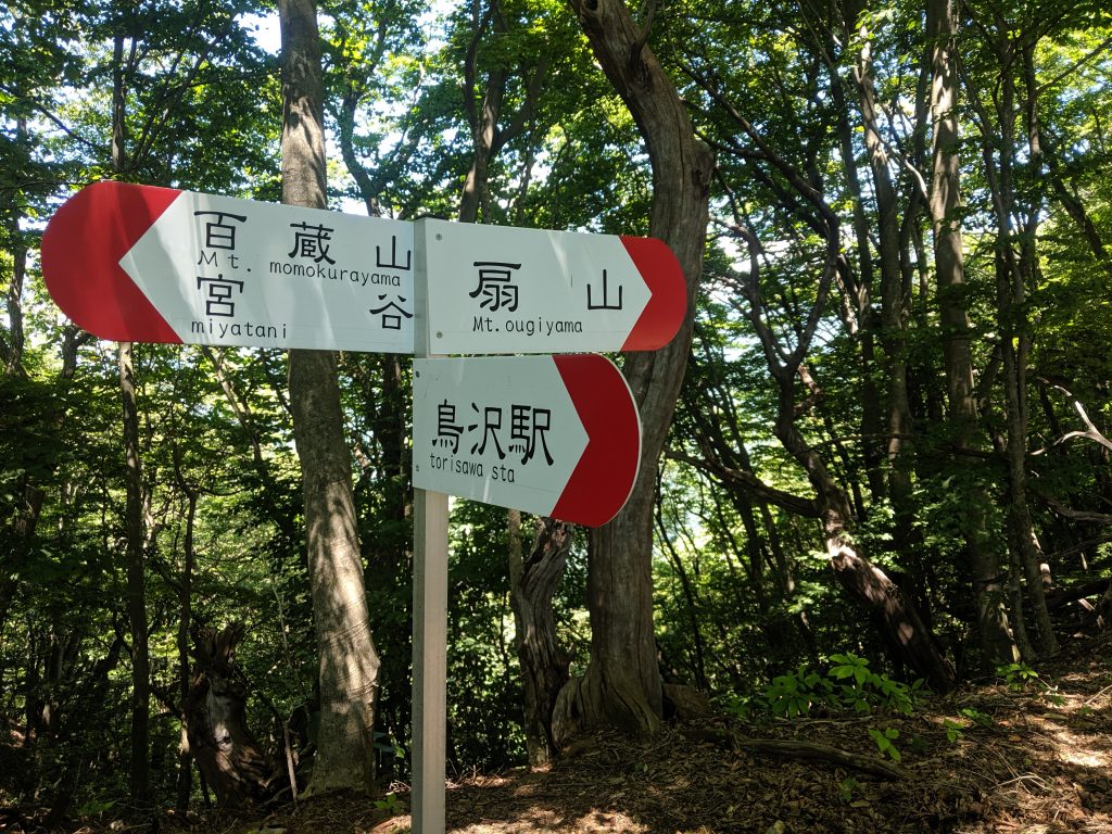
At the top of the ridge, you’ll encounter this sign. Continue to the right to head toward Ougiyama summit and left to go to Momokurayama. 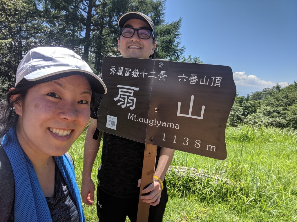
Sara and Ryan take a selfie with the Ougiyama summit sign. 
Ougiyama summit sign with description plaque. On a clear day, Fujisan is visible behind the signs. 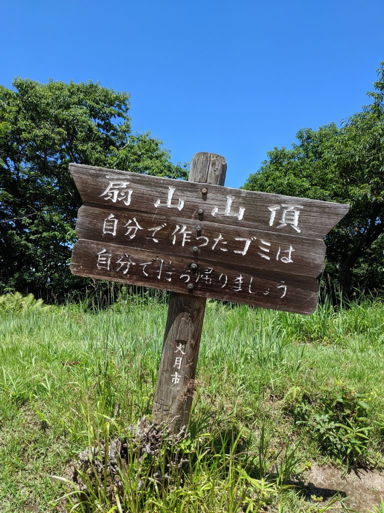
Pick up your trash! 😀 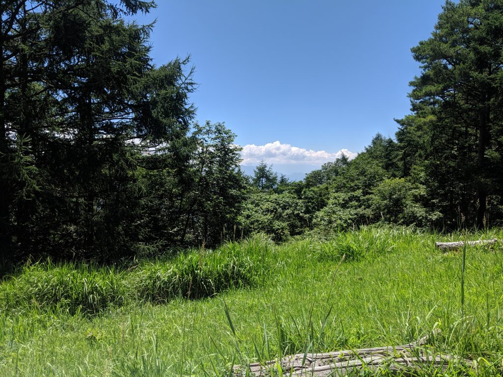
View of Fujisan from Ougiyama. Can’t see anything today! 😞 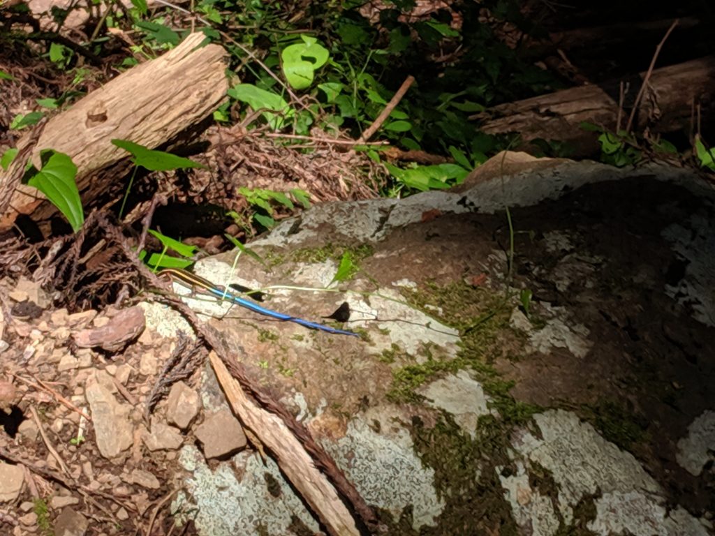
We think it’s a Japanese five-lined skink. One of the many bugs on the path. 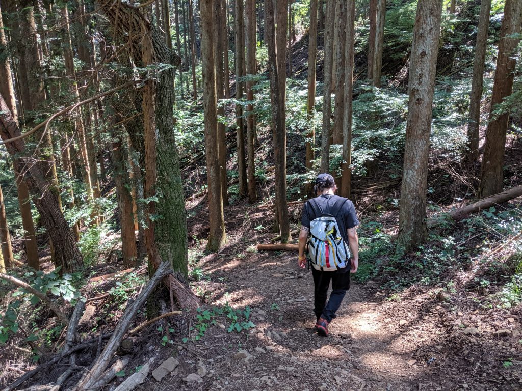
At this point, we were really dehydrated because we didn’t bring up enough water so even the walk down was painful. 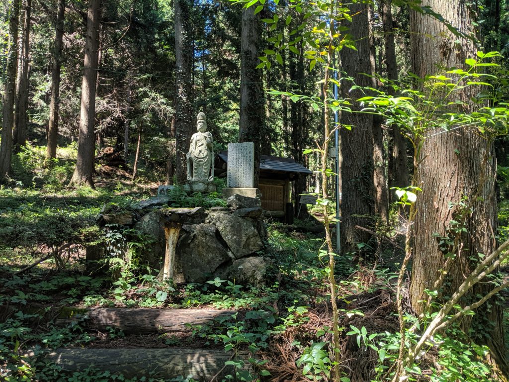
Shrine at the trailhead. We should have left money here too! 
Sitting down in Torisawa station with a view of Ougiyama.
Links we used to research
A lot of blogs don’t link to the sites they used for research, but since we’re deep divers, here are all the links we used to research hiking Ougiyama in order of usefulness. As a note, there are a lot better Japanese resources than English ones.
- https://www.yamakei-online.com/yamanavi/yama.php?yama_id=372 – Japanese site that has a ton of information about the trail along with nice maps detailing all the routes. A lot of the English sites don’t detail facts about the trail like there’s a lot of different trails (like the azalea detour) on these mountains. We took our map overlay from this site.
- https://yamap.com – This is a Japanese app where you can view other hikers and the routes with photos + estimated timings. At the time I wrote this post, there were ~1300 posted activities of climbers hiking up Ougiyama. Very cool app that we’ve been using to plan out our Fujisan hike.
- http://www.city.otsuki.yamanashi.jp/kanko/images/2014-0425-1641.pdf – This is from the Otsuki city site. There’s a bunch of routes they list here as well with timing – If you don’t want to go down the same trail you climbed up, you can go down a different route from the summit of Ougiyama.
- https://teftadventure.wordpress.com/2015/07/01/hiking-in-japan-mt-ougiyama-扇山/ – This site isn’t as pretty, but it has the author’s honest opinion about the hike which was refreshing. This was one of the first English sites we found which openly admitted this trail was pretty steep and fairly difficult.
- http://kenjisaito.com/ougiyama-and-momokurayama/ – We really like sites that document every step you take along your trail and Kenji’s blog does just that. Not a ton of detailed information, but you can pretty much walk the trail with Kenji.
- https://ridgelineimages.com/hiking/mt-ougiyama/ – This is a site with beautiful photos and a bit of hiking information, but compared to the Japanese sites, it’s not very detailed nor informative. Definitely go here to take a peek at what photos you might be able to take during your hike (assuming you even do the same trail).